Hiking The Green Gardens Trail in Gros Morne National Park
 A recent tweet on the ole’ Twitters reminded me of something I think of every time I go to Gros Morne: “It is God’s country because He spent half an hour more creating Newfoundland”
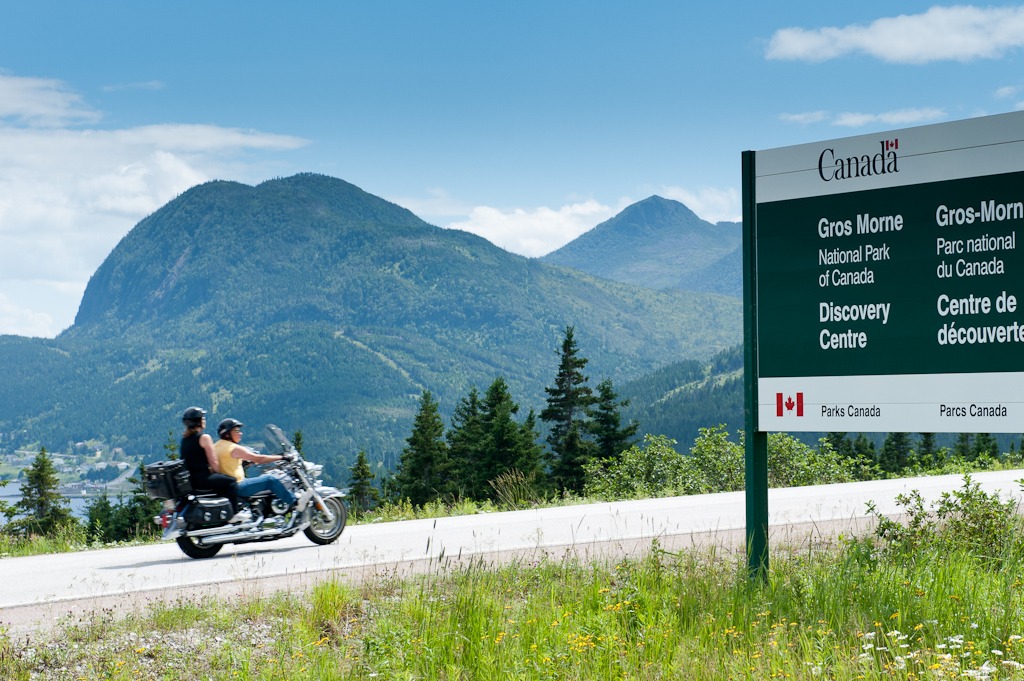
The more of this province that I see, the more I find it increasingly hard to believe that this isn’t the case… Especially when you think of the UNESCO World Heritage site that is Gros Morne National Park. If you are a Newfoundlander and have not been to Gros Morne to walk but one of the easy trails through the Tablelands or Green Gardens, you’ve been doing yourself a massive disservice in life.
-
-
Our trip to the west coast this July was a nighttime drive which generally means sleep. However…
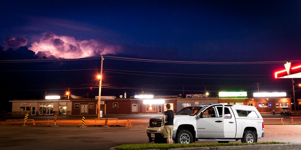
Newfoundland did not disappoint as a massive thundercloud covering the whole of the Great Northern Peninsula was visible to us before nightfall as we began to drive through Terra Nova National Park. We were bathed in frequent lightning all the way from Clarenville to our lodge in Lomond River, just on the boundary of Gros Morne. It was incredible and not something I’ve ever witnessed in Newfoundland (or Florida for that matter). We had no rain or thunder and the cloud cover was nil, the stars plainly visible. What a show, what an island.
-
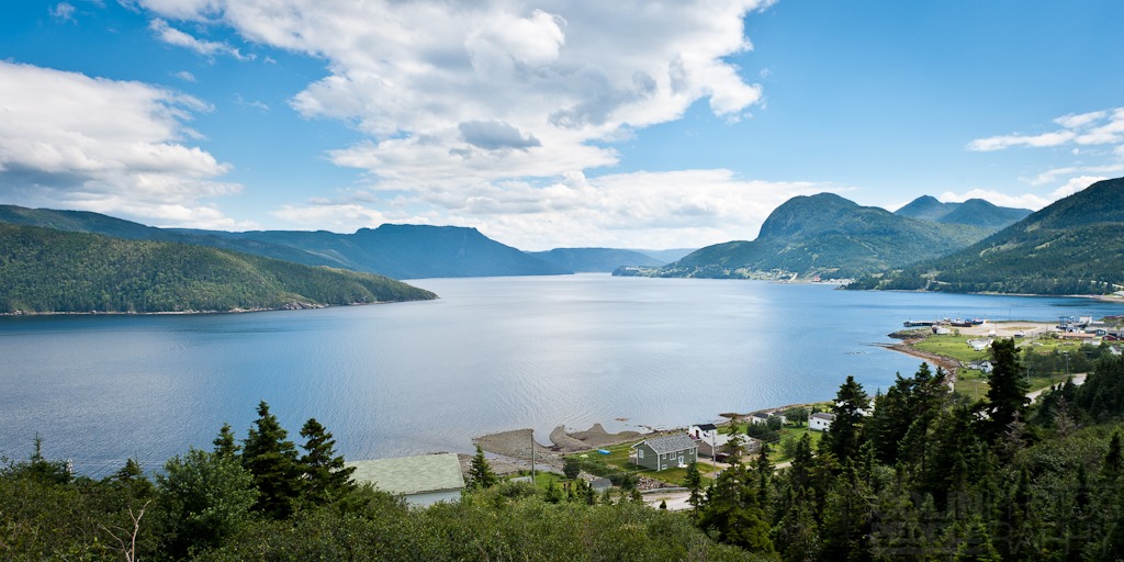
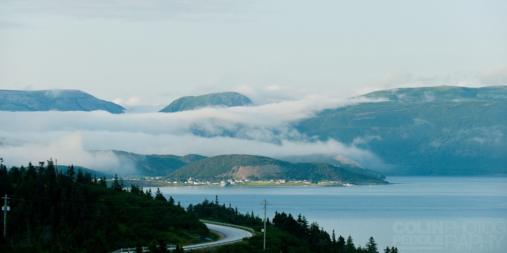
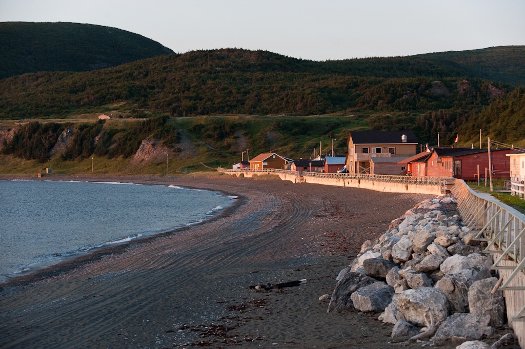
- This is Bonne Bay
-
-
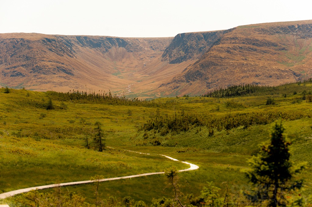
Heading into The Tablelands.
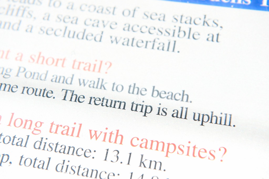
The next morning I wanted to get the lengthy Green Garden hike out of the way on the first day. Unfortunately I awoke with a massive knot in my side which was affecting my breathing. Naturally I took two ibuprofen and after an hour of lying around, I took off for the Green Gardens anyway. Having lost half the day due to the pain in my chest, I opted for the shorter hike from Long Pond as opposed to the longer Wallace Brook trail (next time though).
-
-
This sign greets you at the beginning of the trail for Green Gardens
Not that the shorter trail would be any easier. In fact, the return leg would prove to be a good challenge, as the climb back up from the coast is as the sign says “all uphill”.
-
-
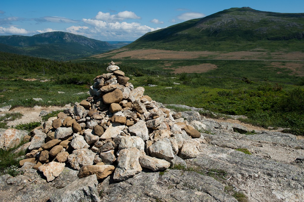
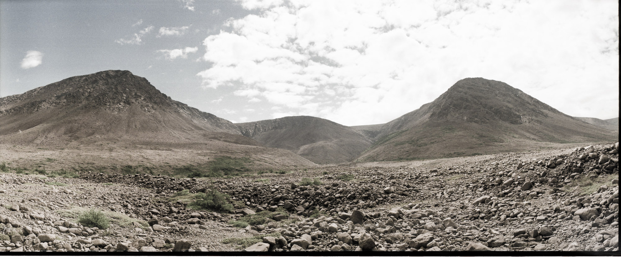
This is a huge rock pile, which I guess you could label an Inukshuk, sort of. This marked the beginning of the descent on the short trail of Green Garden.
In the background you can make out The Tablelands.
-
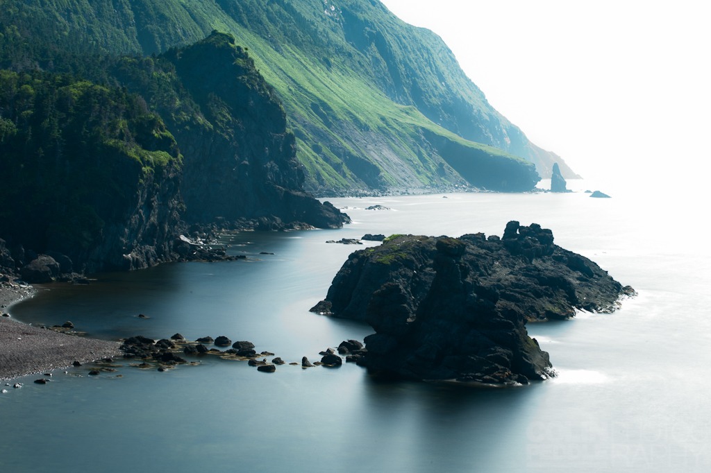
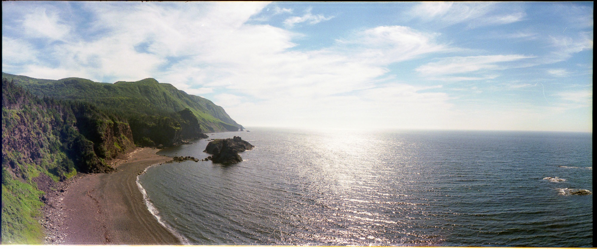
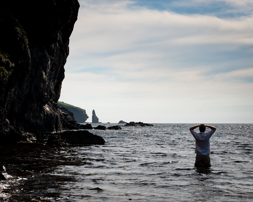
- This is the first sight your given when you reach the ocean. It’s absolutely amazing. To give you a sense of scale, in the distance on the side of that cliff are sheep grazing. Impossible to make out in this picture I know, but trust me, they’re there.
-
- Another view of the same location, but a little wider to give you a better sense of scale.
-
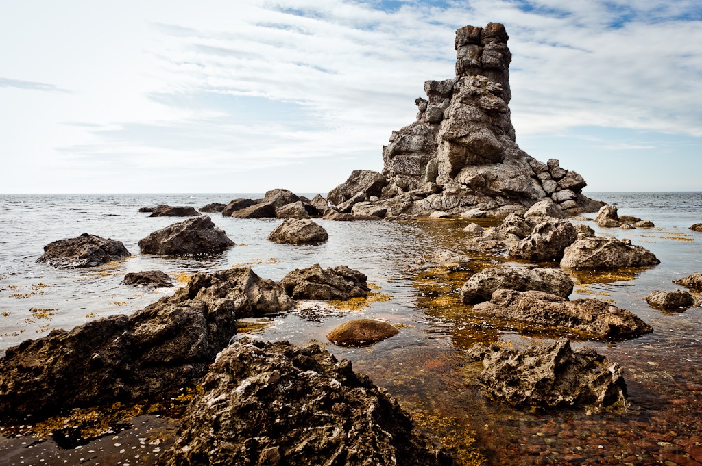
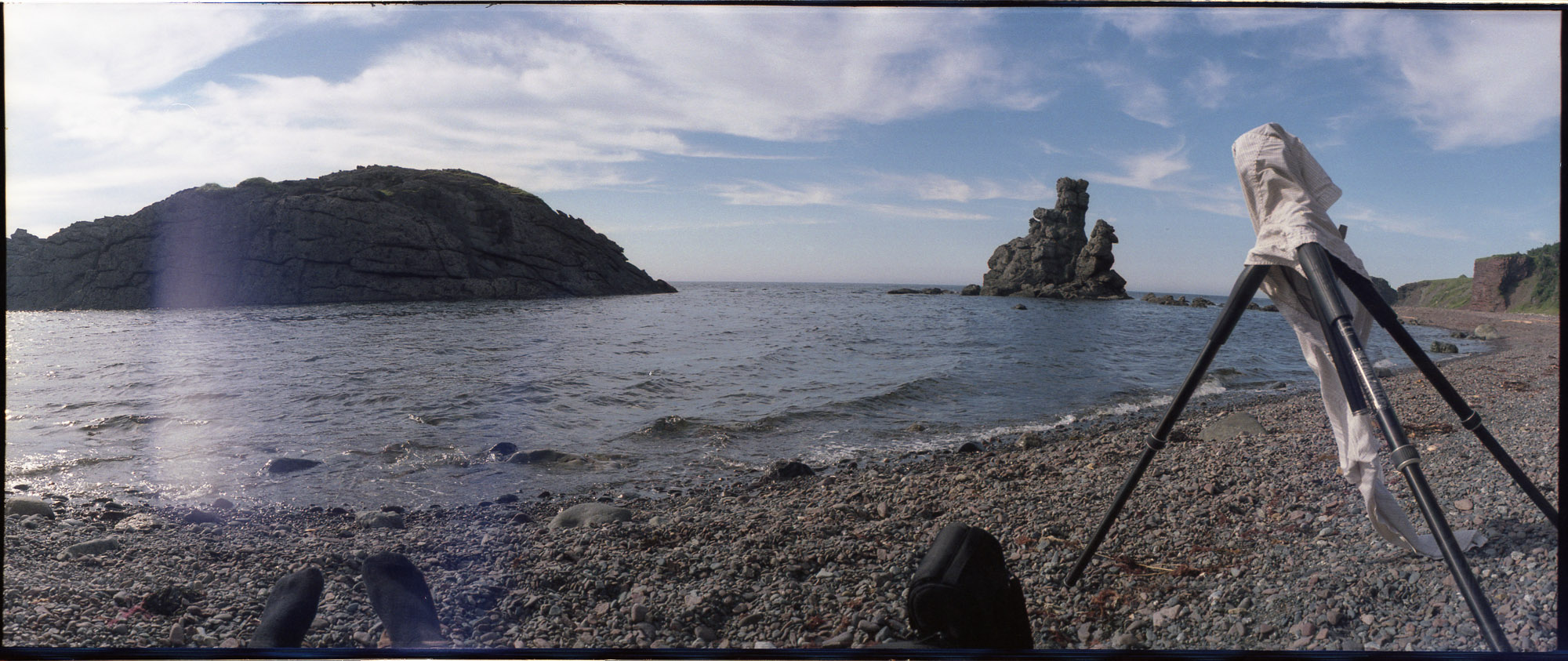
- This is what is called The Stack. It’s an eroded clump of rocks sitting at the edge of the shoreline. Here now, gone tomorrow.
-
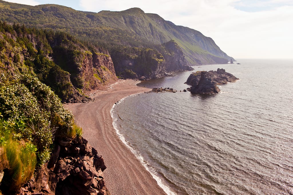
- Every time I look at this picture it reminds of the television show LOST (which was filmed on location in Hawaii).
-
-
If you’re going to do this trail, you’ll be fine with a single bottle of water which you can refill from the waterfall at the end of the beach. It’s about as clean a drop of water that you’ll find in life. Also, be prepared to want to go for a dip in the ocean.
I did.
-
-
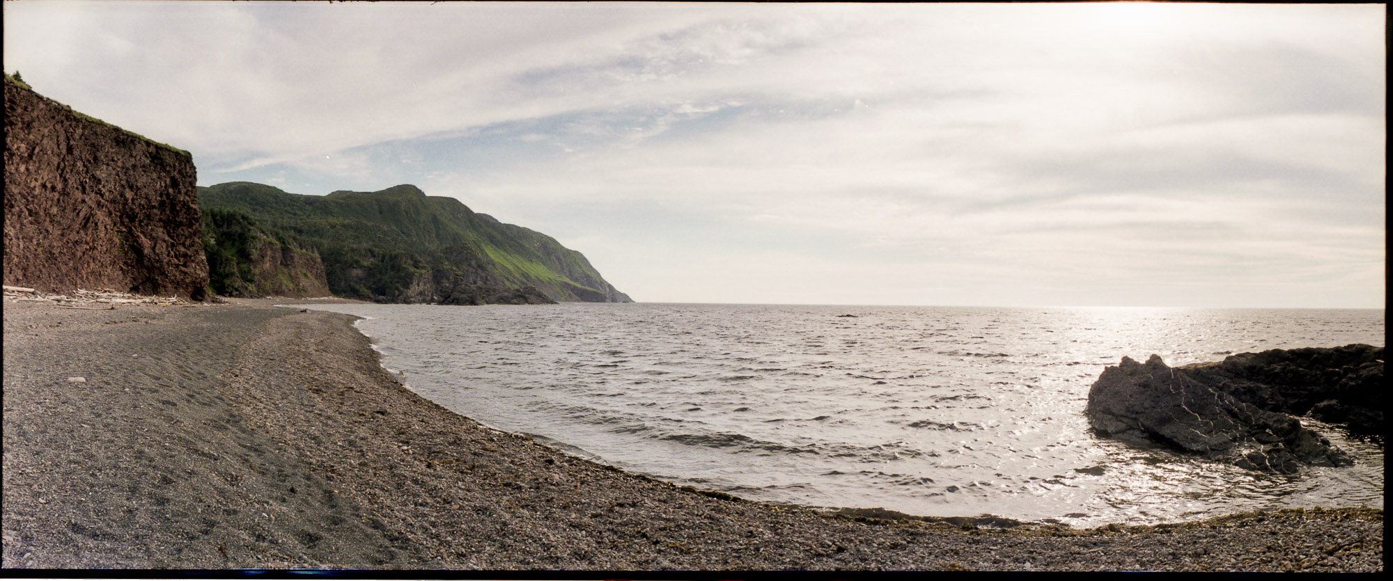
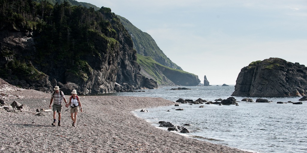
Though it was peak tourist season there were not that many people around. In the distance is a river with a waterfall slightly up the river if you hike it.
When it comes to getting there you’ve got two options, one longer (Wallace Brook) and one shorter (Long Pond) and both can be done by the whole family as the walking is no different then a sidewalk. It’s definitely one hike I’ll be doing again, specifically the longer version, packing a lunch to spend the afternoon on the beach.
-
- The next day brought rain in the morning but it soon cleared into a spectacular day out in the Tablelands and my first journey into the Winterhouse Brook Canyon was underway, unfortunately, the weather had delayed me again so my plans to find a route to the top of the Tablelands were modified into exploring the just the depths of the Canyon and scouting for a hike in the future.
-
- Here I am again taking in the view as the fog rolls in from Bonne Bay.
-
-
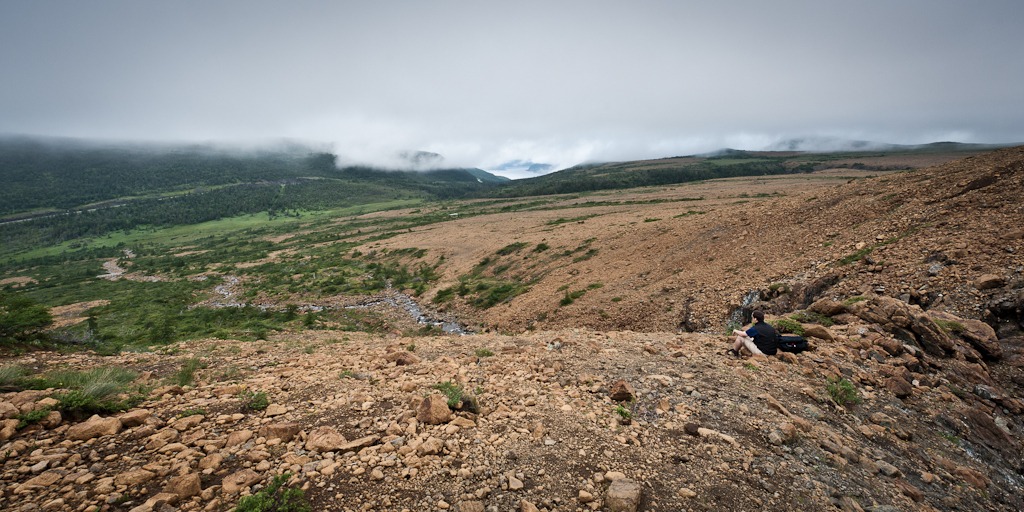
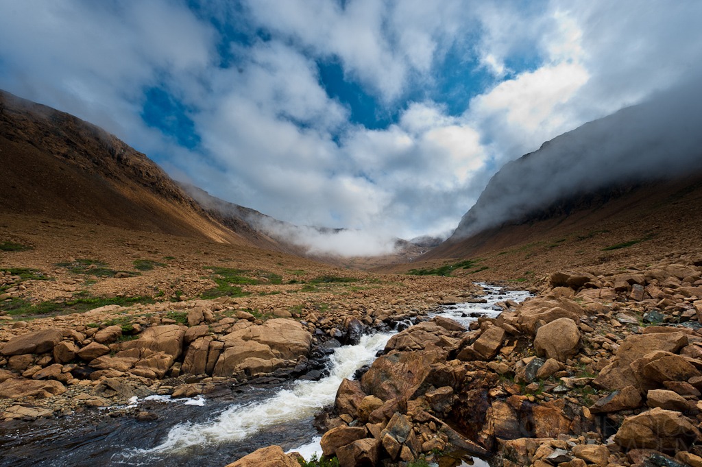
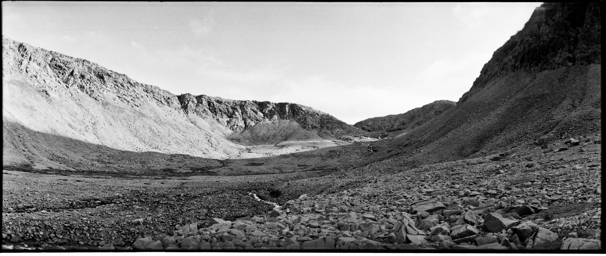
This is from near the base of Winterhouse Brook Canyon where the marked trail ends
The picture shows the fog flowing through the valley of the canyon, it’s hard to get scale for height, but that isn’t low lying fog you’re seeing, it’s proper clouds on the ground or rather, ground in the clouds.
Looks are deceiving and it was only after doing the 5km hike up the lookout behind the Discovery Center did I realize how high up this section of the Tablelands really is.
-
-
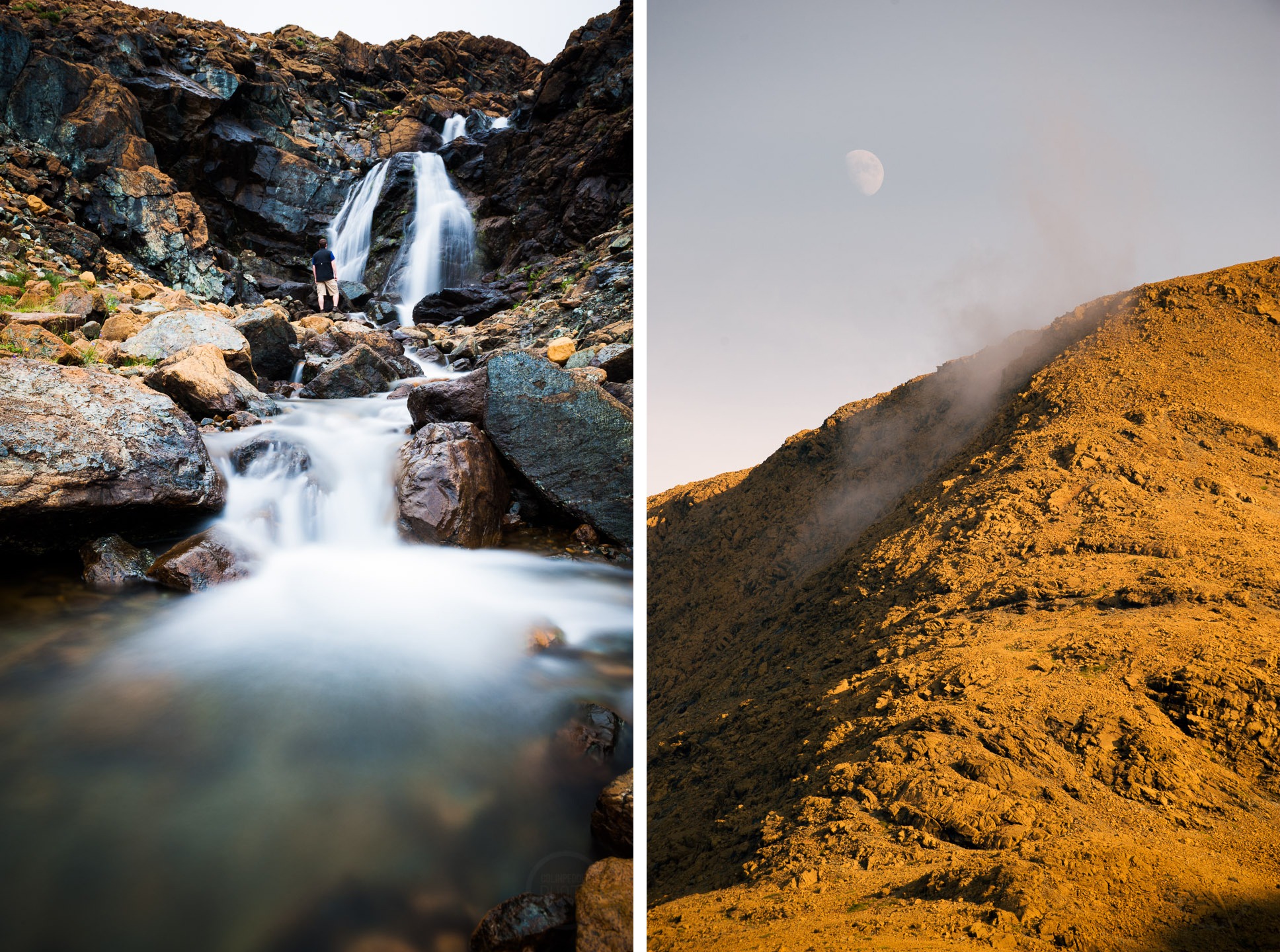
Here I am taking in the waterfalls. (left) From way down below on the trail they look so small.
One thing I did before entering the Canyon was scale a quarter of the mountain to a set of waterfalls (above). The fog pictured below above Norris Point and Bonne Bay was the reason I was hesitant to make the journey to the top of the Tablelands on this day. With no marked trail up or down, you need 100% clear conditions or risk being stranded… which would be fine in a situation with some trees for cover, but up there there is absolutely nothing.I decided it was time to ascent a little and make my way up the Winterhouse Brook Canyon.
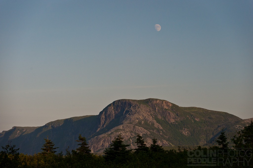
The moon rising over the Tablelands, Gros Morne
The sun was also getting low in the sky and I knew it was time to be leaving.
-
-
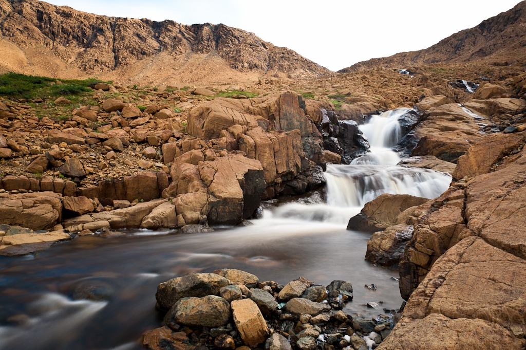
This is the waterfall you can just barely see the whites of way off in the distance (center) of the previous photo. It was a long rocky, knee testing, walk.
After a very long and tiring hike over some of the most ankle breaking terrain you’ll find, I’d reached the bottom of the falls. Unfortunately, I’d chosen the right side of the river which brought me only so far before being pinched by an impasse. A steep rock slide combined with the river meant I’d reached the end of my journey as the only passable spot on the river was an hour or so back.
-
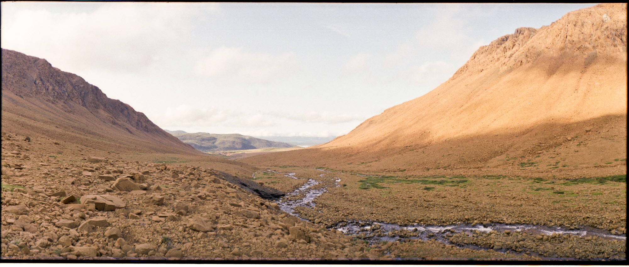
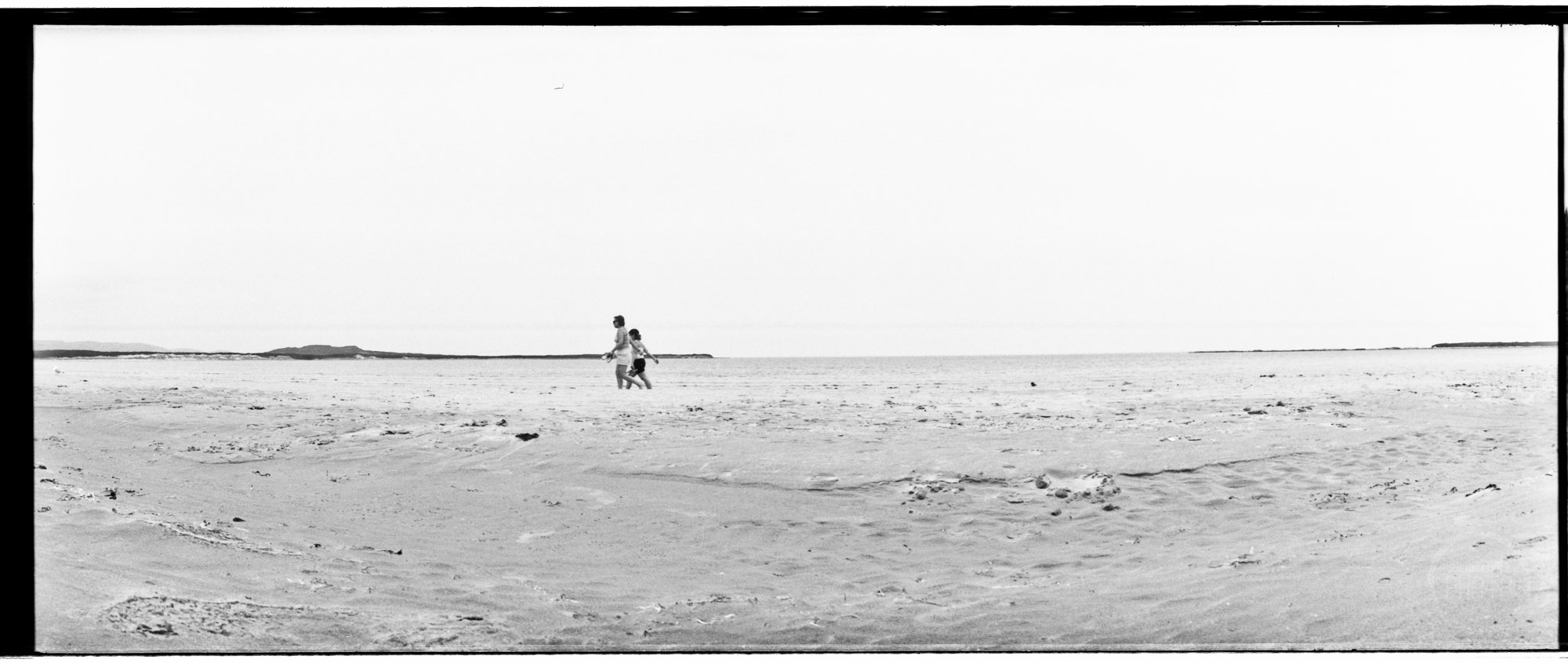
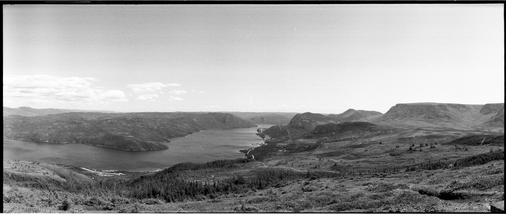
- This is the reverse view shot with the Horizon 202 Panoramic camera.
-
- The views on the way out were just as stunning as on the way in. A thick fog had settled on the other side of Bonne Bay near Norris Point and Rocky Harbour. As well, the moon was showing it’s face just above a Tablelands still being teased by the fog.
-
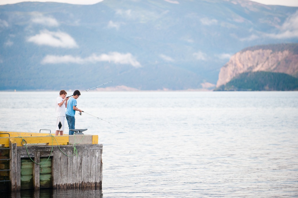
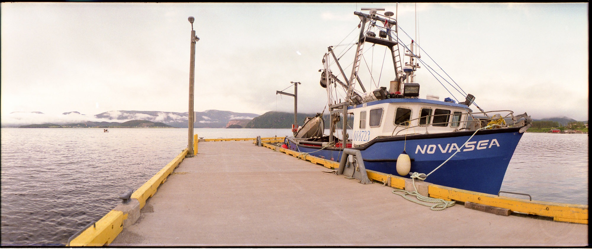
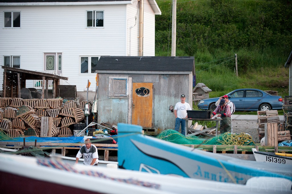
- When I came back down from the mountains I took an evening drive around Woody Point. These kids were enjoying the evening fishing from the wharf.
-
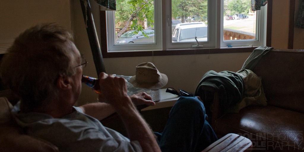
- That evening we decided to take a spin down to Trout River again. Dad and Frank wanted to try out a real deep pool on the river that the locals call “Deep Pool” (no joke). This is a shot of the Tablelands from the backside
-
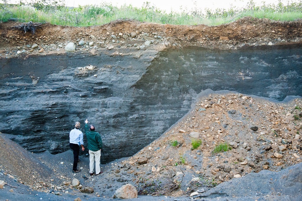
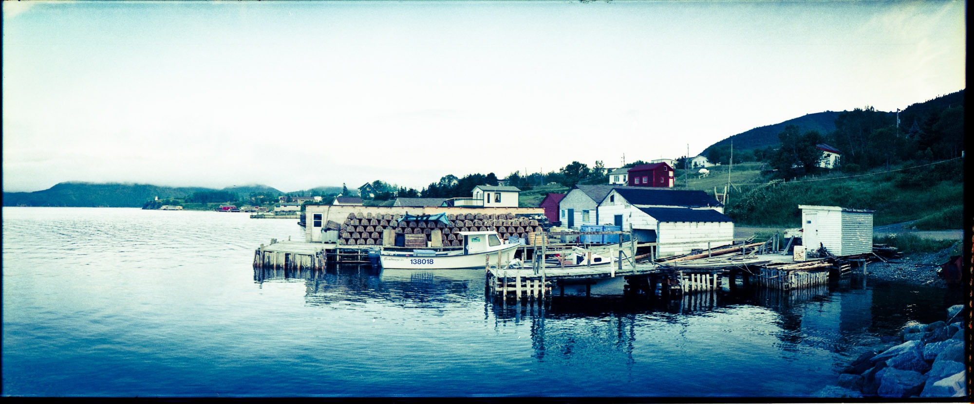
- In case you don’t know, Trout River is made from sand. The entire community is just, sand.. Everywhere you look, sand. The picture below is all natural sand that’s been dug away at, near the bottom layers where Frank and Dad’s knees are, they were picking out ancient sea shells.
-
-
Shallow Bay Beach, Florida in our backyard
The next and final day in Gros Morne I woke up and decided that it was high time I relaxed, so I took off for the golden sands of Shallow Bay. Easily, one of the best spots in Newfoundland. On a hot, sunny day in the middle of July you wouldn’t be able to tell it from Florida, except for the lack of people. I took only one camera with me, my panoramic Horizon 202.
-
- Of all of the communities that make up the Gros Morne area, from Woody Point to Rocky Harbour or Cowhead to Saint Pauls none of them – to me anyway – exemplify a typical community in Newfoundland and Labrador like Trout River does. It’s easily one of the most relaxed, friendliest and beautiful places in Newfoundland and every time I’ve been there, there have been fellas on the wharf, doing what Newfoundlanders are meant to do: fish.
-
- Trout River B’ys. With my camera and huge lens I can only assume they thought I was DFO coming for them. :-)
-
-
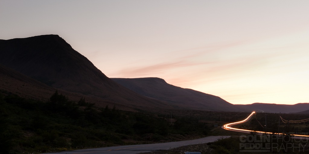
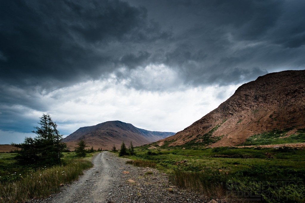
A car travels through the Tablelands from Trout River at dusk in Gros Morne National Park
On the way back from the Tablelands we stopped in the parking lot at the base of the Tablelands and while Frank and Dad had a nap I shot some time lapse long exposures of the sun setting on the mountains.
-
- The next morning I woke up early and took off to do the 5km return hike to the Lookout behind the Tablelands interpretation center. It was interesting. I almost bumped into two moose on the way up, one of which was a very keen bull.
-
- At the top you’re quite a ways up but still not as high as the top of the Winterhouse Brook Canyon, where I’d been just days earlier.
-
- Frank laughing at the fellas who’ve overdressed for the occasion.
-
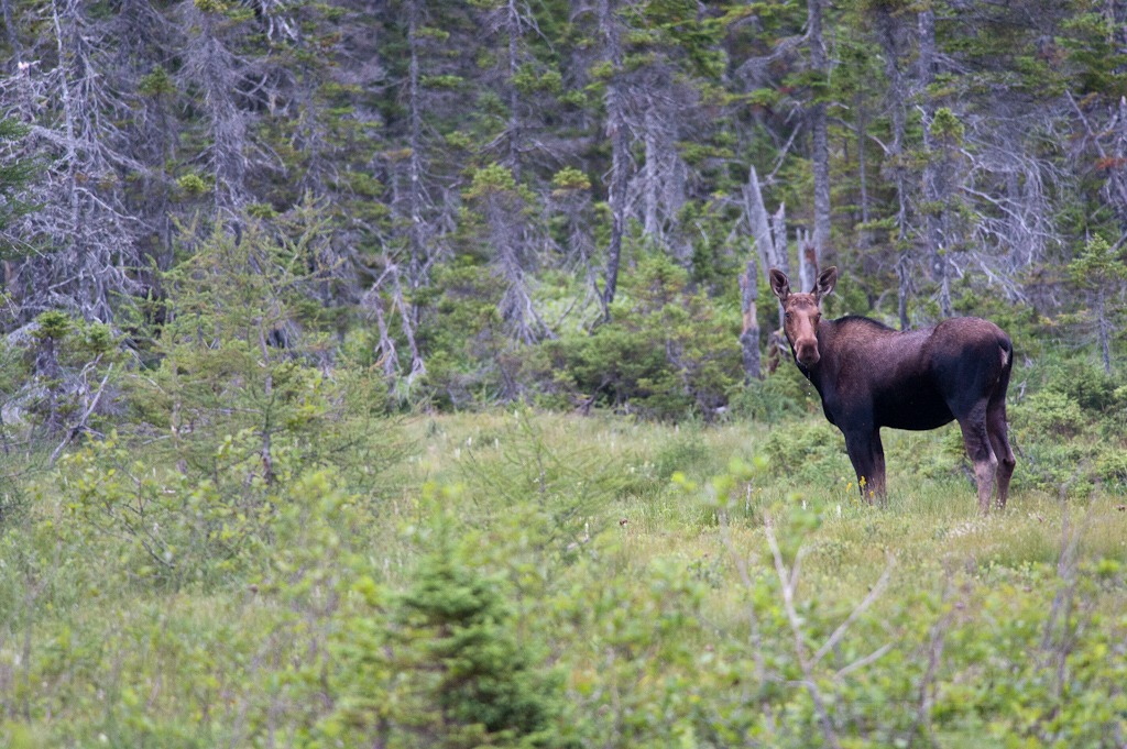
- When I’d returned to camp it was beginning to cloud up quite nicely and storm clouds were brewing; rain was on the way. But this was good news and I took off for the Tablelands to capture some of the dramatic cloud action. Along the way I met a moose, who was also enjoying life on the high cut overs between Lomond and Glenburnie.
-

-
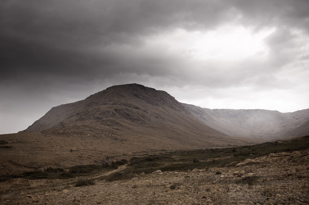
The Tablelands before the storm.
The clouds were full of rain and after a 2km hike into the bottom of the Canyon it decided it was time to rain, so I shot my pictures and hiked the 2km back in the driving rain, in the dark, alone and without music because the rain broke my headphones.
-
- A storm is brewing in the Tablelands
-
-
That right there is rain falling deep in the canyon.
-
-
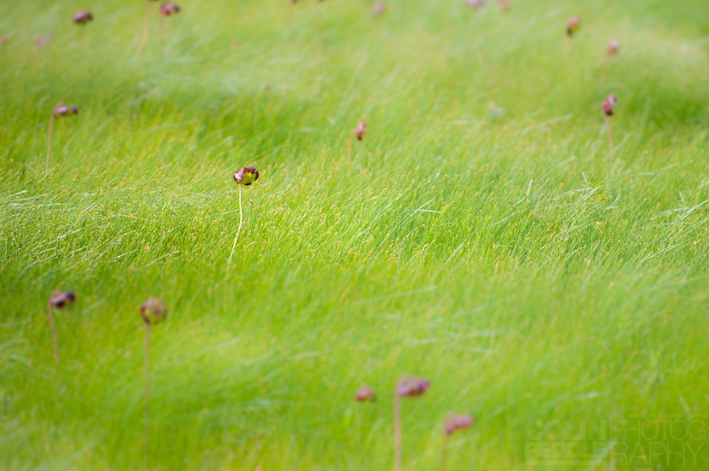
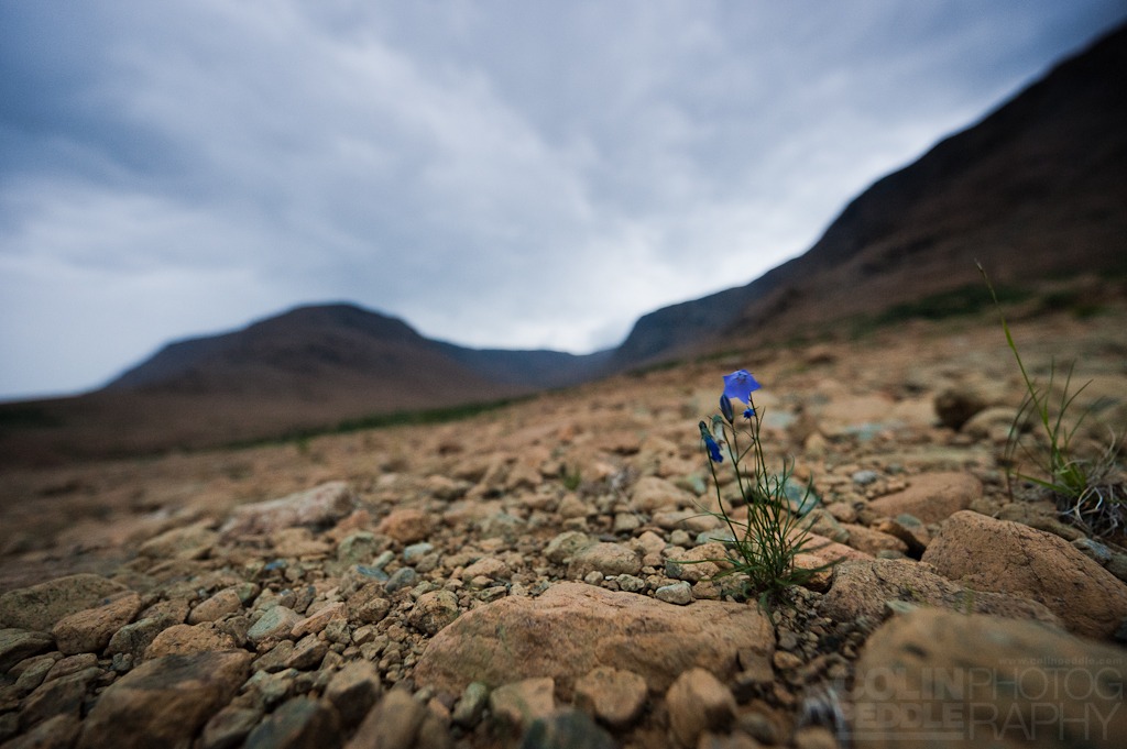
The final picture of the trip was of this little flower. The Tablelands are quite barren and the rock type found there is filled with elements that tend to kill all signs of life, such as grass or trees.
So that’s it, look for a few of these pictures in the shop to purchase real soon and leave a comment if you like them!